
Walk an Olympia Street
A street-wide search can establish which parcels line an Olympia road, who appears as each assessed owner, and which recorded documents relate to the land. It cannot produce a full household roster. The cleanest route starts with Thurston County A+ Parcel Search. Search the street name without its type or direction, then sort the results. The parcel number becomes the durable key for map, deed, and permit work.
- Enter the street name in A+ without “Street,” “Avenue,” or a directional suffix. Sort by address to make the block sequence easy to read.
- Open each property number and record its parcel number, situs address, owner or taxpayer name, legal description, and city status.
- Open the county Property Map, locate the parcel polygon, and inspect the parcels beside it. Treat the boundaries as reference data, not a survey.
- Search the owner as grantee in the Auditor index. Find the purchase deed, then use its grantor and legal description to move backward.
- Add city permits, lawful voter-file evidence, and old address directories as dated context. Cross-check before linking any name to occupancy.
This Olympia street directory method separates a title fact from a resident clue. A trust, business, or estate may hold title. The tax-mail address can be elsewhere. An old directory entry proves only that the publisher printed that listing in that year.
Search Olympia Streets in A+
A+ supports an exact parcel route, an owner or taxpayer search, a complete address search, and a whole-street browse. The instruction to omit street type and direction matters because directional suffixes are common in Olympia. Double-click the property number at the far right of a result to open the parcel record. “New Search” clears the prior terms.
| A+ field | Input | Required | Use by street |
|---|---|---|---|
| Parcel Number | Text | Parcel mode | Enter the exact 11 digits |
| Owner/TX First and Last | Text | No | Owner or taxpayer, not all occupants |
| Street Number and Name | Text | Address mode | Use for one complete address |
| Street Name Only | Text | No | Returns a street-wide parcel list |
| Sort Order | Select | No | Owner Name, Address, or Parcel Number |
| Property number | Result link | Not applicable | Opens ownership and parcel details |
The Assessor’s public-records page says ownership, location, characteristics, legal descriptions, and sales already appear through A+, so a separate request is not normally needed for those facts.
The live A+ property search is shown below.
The screen keeps street name, owner, and parcel as separate routes. That helps prevent an owner search from being mistaken for a list of people at one address.
Note: A+ is a current assessment snapshot; it does not guarantee that the listed owner lives at the situs address.
Map Olympia Street Parcels
The Thurston County GeoData Center map menu adds shape and jurisdiction to the street directory. Its Property Map can show parcel boundaries, owner name, parcel number, address, ZIP, and whether a parcel lies in a city. Other viewers cover permitting, elections and schools, critical areas, habitat planning, sheriff crime data, and a broad map.
Search one address or parcel, zoom to the selected polygon, and click the parcel beside it. Then carry that parcel number back to A+. This is the documented adjacent-parcel method; no named buffer or radius control was confirmed. Zoning, aerial, and environmental layers explain land context, not who occupies a building.
The county’s online map choices provide the visual starting point.
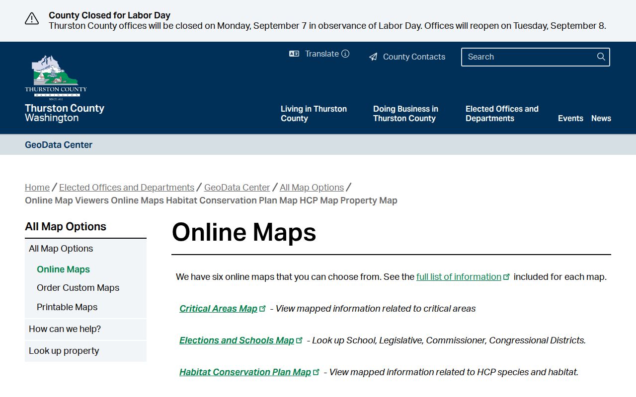
Use mapped polygons to keep neighboring lots distinct, especially where one postal label spans city and unincorporated land. County maps are not survey or legal-grade products.
Read Olympia Address Fields
Three address forms answer three different questions. Confusing them is the most common street-search error. A mailing destination can name a trust, care-of party, business, or out-of-area address. It is useful for notice and tax mail, but it is not proof that anyone lives on the parcel.
- Parcel
- A numbered unit of land in assessor and map systems. Thurston A+ expects an exact 11-digit number.
- Situs address
- The physical location assigned to property. Use it for maps, permits, and address searches.
- Plat
- A recorded subdivision map that identifies lots, blocks, and roads. In EagleWeb, a plat name is searched as grantor.
- Legal description
- The lot, block, plat, or metes-and-bounds wording that identifies land when a street label fails.
- Criss-cross directory
- A directory arranged by address or phone number rather than only by surname.
Old descriptions may rely on landmarks that no longer exist. When a current address fails, the legal description, subdivision name, survey, or map case can preserve continuity across the change.
Olympia Records Indexed by Address
No one record supplies every name on an Olympia street. Each custodian records a different event: assessment, mapping, transfer, construction, registration, or publication. The parcel number and legal description connect many systems.
| Address record | Custodian | Evidence | Access route |
|---|---|---|---|
| A+ parcel roll | County Assessor | Owner, situs, legal facts, sales | Web search; 360-867-2200 |
| Property Map | GeoData Center | Geometry, city status, ZIP and layers | Public map; not survey grade |
| Deeds and plats | County Auditor | Parties, documents, legal description | EagleWeb, office, mail, archives |
| Permits | City Permit Center | Project, parcel, status, documents | SmartGov public portal |
| Code cases | Code Enforcement | Complaint and case evidence | Online report or PRA request |
| Voter file | Secretary of State | Bounded registration fields | Extract request with limits |
| Old directories | WSL and Timberland | Dated address or listing | On-site, database, microfilm |
The assessor owner points to the newest deed. That deed supplies a seller and legal description. A permit may name an owner, contractor, architect, or agent, so it cannot prove residency. A code complaint is not a final finding.
Follow Olympia Street Deeds
The Thurston County Auditor’s property-record instructions lead to EagleWeb. Search by name or parcel, Auditor File Number, or Volume/Page. Use the file-number route or volume/page route, not both at once. Deeds, easements, leases, plats, surveys, covenants, releases, land-corner records, and other documents can clarify a parcel trail.
Begin with the current owner as grantee, the party receiving an interest. Open the latest purchase deed and capture its grantor, recording date, file number, and legal description. Then search that grantor as an earlier grantee. Narrow noisy names with document type, date, parcel, plat, or spelling variants.
The official Auditor lookup page is pictured here.

Selected types have online images, but all public records can be viewed at the office. An online image is a standard copy, not a certified one.
Photo copies cost $1 per page. Certification costs $3 for the first page plus $1 for each added page. Requests may go by phone, email, mail, or in person to the Auditor at 3000 Pacific Ave SE, Olympia.
Add Olympia Permit Records
The City of Olympia uses SmartGov for public permit access. Search an address or parcel for project, status, inspection, and document context. Public users can review notices, permit records, status, and available public documents. An account is needed for applications, plan submission, payments, and inspection tasks. The exact history cutoff and full live field set were not verified, so a blank result does not prove that no older work occurred.
The official parcel-search directions say to enter search terms, wait for matching locations to populate, choose the desired record, and then add more text to narrow the result. Keep the parcel number from A+ close at hand. A road name may retrieve several similar locations, while a parcel is less likely to drift when a street suffix or postal city differs.
Code enforcement adds a different layer. Complaint information is public under the Washington Public Records Act, and a complainant may omit identifying information. A victim or witness may seek an exemption when disclosure threatens safety or property, though the City cannot guarantee confidentiality. A complaint reports an allegation. It does not prove a violation or name a resident.
Bound Olympia Voter Evidence
Washington’s requested voter-file extract can include name, address, year of birth, voting history, district, and precinct. Full birth dates, driver or state identification numbers, and partial Social Security data remain protected. Voting history records participation, not ballot choices, and Washington does not register voters by political party. The file is not a casual parcel-by-parcel street map, and its use restrictions matter.
An Address Confidentiality Program participant may use a substitute state address in public records. A missing or substitute address may reflect a safety measure, not bad data. Registration records also omit people who are not registered to vote. Use voter evidence through the authorized state or county route and never publish a block roster.
Check Old Olympia Street Listings
For a dated occupant clue, consult Olympia directories at the Washington State Library, Olympia Timberland Library, or HeritageQuest. The exact reverse-directory run was not located, so inspect address or classified sections in each volume rather than assuming every year has a criss-cross index. Telephone books can supply a listed phone and address, but unlisted homes will be absent.
Historical city labels spill beyond today’s limits. Some Olympia volumes include Lacey or Tumwater in specified years. Resolve an old street string against maps and legal descriptions before deciding two listings describe the same parcel. Check adjacent years because publishers skipped some households and whole volumes have gaps. The Olympia directory-book page covers year runs and shelf access.
Olympia Timberland Library has a microfilm reader and can help locate a specific obituary or newspaper item. HeritageQuest requires library access, and Ancestry Library Edition is limited to in-library use. The Washington State Library in Tumwater holds the broad directory and telephone-book runs for on-site research. Ask staff about the exact year before visiting, since the catalog shows many gaps and some titles combine Olympia with nearby communities.
Limits of Olympia Street Records
A public property record identifies an assessed or titled owner, not every person who lives there. Utility customer lists and motor-vehicle address data are not public household sources. A deed party may be a trust, business, estate, or representative. Permit names can describe professional roles rather than occupants.
Time also changes the meaning of a match. An assessment page is a current snapshot, a deed records a transfer event, and a printed street directory reflects one publication year. Court and permit databases may omit older material. Write down when each record was issued or accessed. If two sources disagree, give more weight to the custodian responsible for the exact fact, then request the underlying document when the index alone is unclear.
Use two independent custodians before associating a person with an Olympia address. Match the parcel or legal description as well as the name. Record the date of each source, since a voter extract, assessment snapshot, deed, and printed directory may describe different moments. A no-result response is not proof that a household or document never existed. It may signal a spelling change, an archived volume, a protected address, or a portal coverage gap.
For an unresolved search, save the exact terms used and contact the custodian. The Assessor can address parcel data, the Auditor handles recorded documents, the Permit Center holds city permit records, and the library or archives can identify an older volume. A focused request is more useful than asking one office for every record tied to a street.
Lawful use. Olympia address records are for lawful personal research, family or house history, and civic inquiry. Never use them to stalk, harass, intimidate, or harm anyone.